Parcel Mapping Services
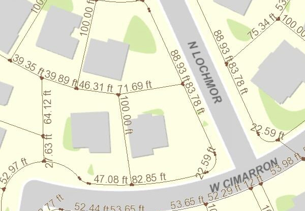
Pristine’s Parcel mapping services is the process in which land parcels are created. The maps created using parcel mapping services comprise of polygons which are created from the base map, which shows the details of the ownership of the properties and related information.
The base maps for parcel mapping services are technically cadastral maps showing each individual plots in different sub divisions. The land parcels in the parcel mapping service are the fundamental data layer over which multiple types of data is referenced.
Parcel mapping services have a variety of uses such as Land administration and property registration by Urban and Rural governing bodies. Use of parcel mapping services also helps in Municipality planning, administration and urban development by using intelligent parcel mapping techniques, which have the ability to restore analytical data that is crucial for enhancing the operational abilities of the Government bodies.
As an instance, the time required to process and fulfil requests for land registry information has dropped by almost 80% in various countries which has led to substantial improvements in handling the enormous requests generated over a period. Better management of services significantly helps in reducing the overhead costs, maintaining and managing the data in a secured environment.
Parcel mapping services are also used by cartographic officials, rescue operations during floods and natural disasters for identifying property owners and retrieving crucial data. Parcel maps are also the base for any such GIS Maps.
The basic advantage of parcel mapping services is that one is able to replace the cumbersome process of maintaining data on paper maps with digital maps resulting on better decision making, data sharing and reduction is operational costs and time.
Pristine has been providing its Parcel Mapping services for many years now to the following industries:
Municipal & other Urban Bodies
Government Departments
Builders
Real Estate Agents
Appraisers
Engineers
Surveyors
Developers