GIS Data Services
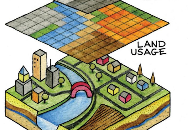
GIS data capture is a technique in which the information on various map attributes, facilities, assets, and organizational data are digitized and organized on a target GIS system on appropriate layers.
GIS Data capture falls into 2 categories;
1) Primary GIS data capture techniques which uses remote sensing and surveying techniques:
Raster data capture: Capturing of attributes, etc without physical contact. This is usually done with the help of satellite imaging techniques, Ariel photography. The advantage of such a GIS data capture is that there is a consistency in the data generated, and the whole process can be regularly and systematically manifolded to get accuracy of the data at a very cost effective manner.
Vector data capture: This includes capturing of data-sets through physical surveying techniques such as DPGS (Differential Global Positioning System) and Electronic Total Station (ETS). Although this technique is the most effective process to have the accurate data on the target GIS system, it is more time consuming and expensive

Scanning the raster data: High resolution scanners give very accurate raster images from the hard copies, which can be georeferenced, and digitized to get the vector output.
Manual digitizing: Digitization is done directly over the raster by the use of a digitizing tablet, which is a manual pointing device that creates an identical vector map on the computer screen, defining the vertices, points, line data, etc.
Heads-up digitizing: This is similar to the manual digitization, but the raster scanned data is imported and laid below the vector data to be traced on the computer screen itself.
Automatic raster to vector conversion: With the advancements of the technology, special softwares using intelligent algorithms have been developed to recognize the patterns of the points, lines and polygon features and capture them automatically to generate vector GIS data.
Photogrammetry: Digital stereo-plotters are used to capture the vector data from the Ariel photographs, pictures and images. This is comparatively the most effective method of accurate GIS data capture, but is one of the most costliest methods too.
GIS Data capture is used in varied fields such as for:
Thematic Maps: Analyzing practical regional / cultural issues, transportation facilitation, hydrographic mapping, vegetation and other types of related features;
Electrical power networks are captured using special softwares for GIS data capture
Navigation data are captured for easy navigation purposes
Land records and survey data are captured for property, land, water and holding tax, etc. The spatial features are extracted from Ariel imagery using photogrammetry methods.
Utility infrastructure GIS data capture for water lines, road network, pavements, sewerage network, and other related features.
Environmental and geological GIS Data capture is done from geological maps, weather maps, mining and mineral exploration maps, etc.